
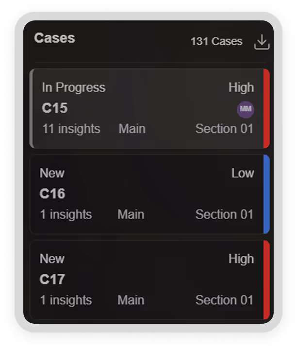
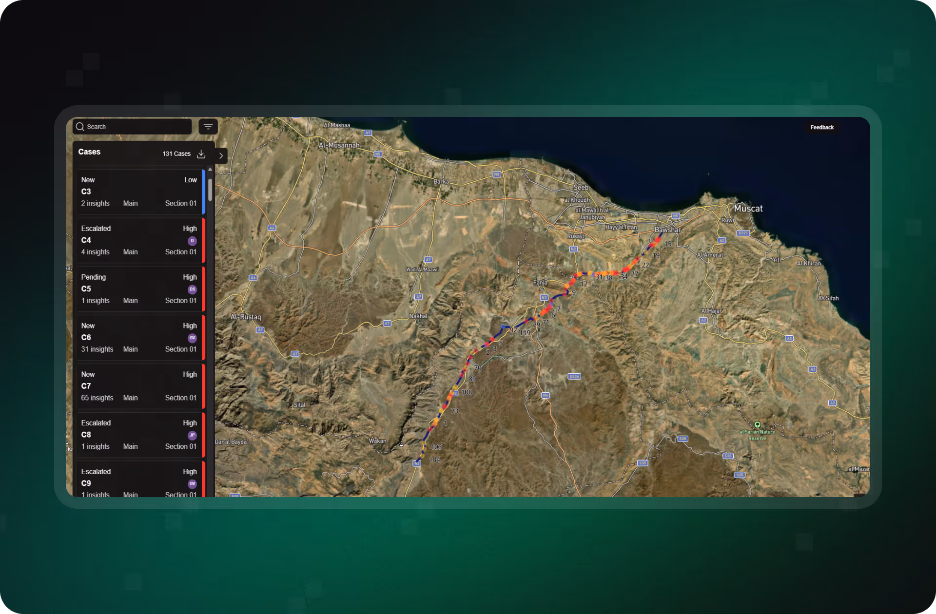
Uncover Hidden Patterns and Emerging Threats Before They Escalate
SurfaceScout analyzes time-sequenced satellite imagery to detect changes across your pipeline corridor, from gradual encroachments to subtle terrain shifts. By comparing imagery over time, our AI uncovers patterns that traditional patrols miss, helping you detect threats earlier, reduce false negatives, and strengthen audit readiness with verifiable historical context.

Trusted by Leaders Worldwide


See What’s Changed.
Before It Becomes a Problem
Most pipeline threats don’t appear overnight. They build gradually, a few inches of land shift, a new tree line, a small excavation that goes unnoticed. Without the ability to look back and analyze change over time, these risks often go undetected until it’s too late. SurfaceScout’s Historical Change Analysis fills that gap, giving operators a visual timeline of evolving risks and the defensibility to back up every decision.
Slow-Moving Threats Still Cause Fast Damage
Subtle risks like encroachment, erosion, or tree growth rarely trigger real-time alerts, but they’re exactly the type of issues that can lead to leaks, failures, or compliance violations if ignored.
Snapshots Aren’t Enough
One-time inspections miss the bigger picture. Without a way to compare historical imagery, operators have no visibility into long-term trends or recurring issues, especially in visually complex areas.
No History, No Proof
When audits or investigations arise, a clear timeline matters. Without visual evidence or historical records, it’s difficult to prove when a threat emerged, how it evolved, or whether the team responded appropriately.
Unlock Deeper Insight With Change Over Time
SurfaceScout analyzes satellite imagery over time using machine learning, helping you detect threats earlier, uncover slow-moving risks, and strengthen defensibility with a verified historical record.
Catch What Doesn’t Trigger Immediate Alerts
Some threats build gradually, like unauthorized planting or land deformation. SurfaceScout identifies subtle changes that typically fly under the radar, helping you catch them before they become incidents.
- Identify slow-developing changes in high-risk zones
- Detect threats that are easy to overlook in static snapshots
- Reduce false negatives and improve coverage in visually complex areas
.avif)
Understand Risk Evolution Across Time
SurfaceScout lets you step back through historical imagery to reveal how threats emerged and changed over time. This improves situational awareness, supports post-incident analysis, and informs future planning.
- Compare historical data to spot patterns and outliers
- Reconstruct event timelines for root-cause analysis
- Support strategic planning with better context
Get the Full Picture Of Your Pipeline
SurfaceScout’s historical change analysis gives you more than alerts, it gives you context. Detect subtle risks early, verify inspection coverage, and strengthen compliance with time-sequenced satellite intelligence you can trust.
How Operators Are Seeing
What Patrols Miss
Explore how customers are using time-based satellite analysis to uncover hidden risks, verify field activity, and turn historical insight into operational resilience.


FAQs
This FAQ covers how time-based analysis supports early detection, audit readiness, and operational clarity, without the need for manual review or data stitching.


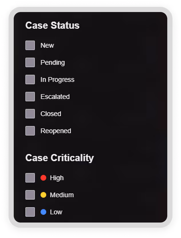
What is Historical Change Analysis in SurfaceScout?
It’s a feature that compares satellite imagery over time to detect gradual or hidden changes, such as encroachments, erosion, or land use shifts, that may not trigger immediate alerts but still pose risk.
How far back can SurfaceScout analyze changes?
We maintain historical satellite data that allows for multi-year comparisons, depending on your corridor and monitoring cadence. This supports trend identification and proof of past conditions.
What types of risks can be uncovered through change analysis?
Historical Change Analysis detects slow-developing or masked risks like terrain shifts, vegetation encroachment, unauthorized land activity, and other patterns that static or snapshot-based monitoring might miss.
How does this support audits or investigations?
You can visually validate what happened, and when. By comparing past imagery and tying it to field activity, SurfaceScout helps teams verify inspections, show due diligence, and resolve audit queries with confidence.