Send Crews Where They’re Needed Most
Routine patrols waste time and resources inspecting low-risk areas while missing critical threats. SurfaceScout uses satellite imagery and AI to pinpoint real risks, turning them into actionable cases with full context for crews, resulting in fewer unnecessary site visits, faster resolutions, and verifiable proof of every field action.


Trusted by Leaders Worldwide


Field Operations Waste Resources Without Reliable Data
Most operators still rely on fixed patrol cycles and routine inspections. Crews are sent out on expensive site visits regardless of actual need, often returning with little to report while critical risks elsewhere go unchecked. This leads to wasted budgets, inefficient use of manpower, and delayed interventions where they matter most.
Routine Patrols Create Inefficiencies
Scheduled inspections cover every span on a timetable rather than based on risk. The result: teams waste hours in low-threat areas while high-priority issues go unseen until they escalate.
Urgent Risks Slip Through the Cracks
Without risk scoring or data-backed guidance, field teams often lack clarity on which sites matter most. This scattershot approach means dangerous issues can be missed while resources are drained elsewhere.
Manual Processes Create Bottlenecks
Case creation, tasking, and reporting are often split across spreadsheets, emails, and siloed systems. This fragmentation increases delays, duplication of work, and the chance of human error in critical situations.
Audit Pressure Demands Proof
Regulators and internal auditors expect defensible records of every field action. Yet crews rarely have streamlined tools to capture timestamped, geo-referenced evidence, leaving compliance gaps and extra administrative burden.
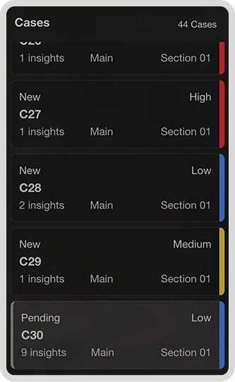
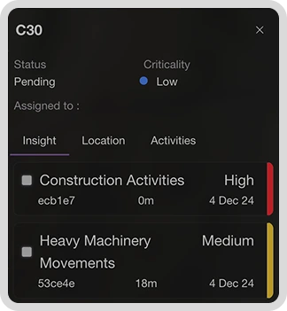
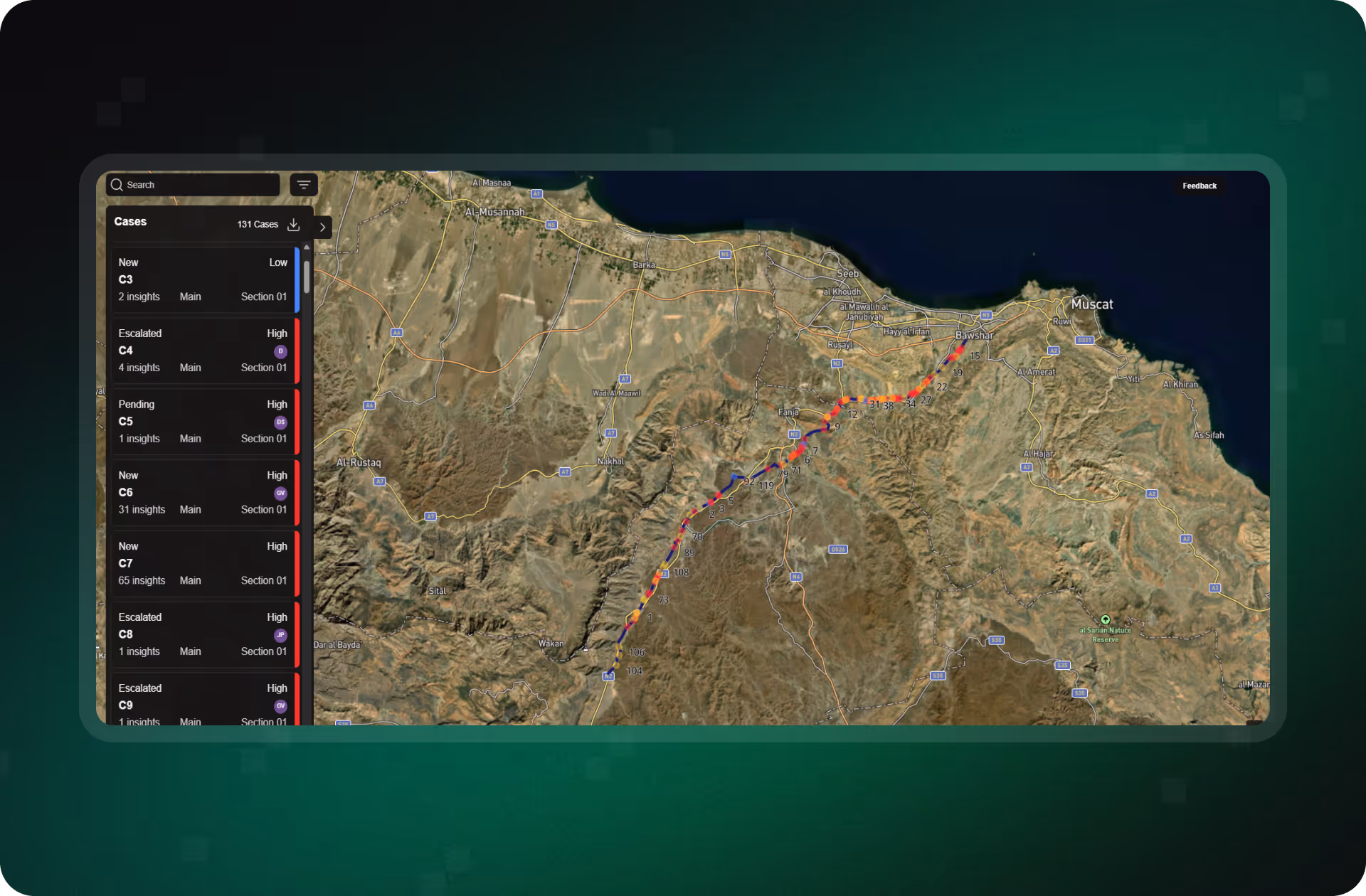
How Operators Optimize Field Work With SurfaceScout
SurfaceScout helps operators focus field resources where they’re needed most. By turning satellite intelligence into actionable cases, it reduces wasted patrols, prioritizes urgent risks, and streamlines every step of the field workflow, from dispatch to audit-ready proof.


Detect Hazards Before They Become Emergencies
Continuously monitor your entire corridor with satellite imagery and AI. SurfaceScout flags third-party activity and natural hazards early, no flyovers, no blind spots.

.avif)
Turn Insights Into Coordinated Action
Create and manage cases in one place. Assign tasks, track updates, and collaborate across teams with real-time status changes and field-uploaded photos.

.avif)
Prove Compliance With Defensible Records
Log every decision and action, from risk detection to resolution. Export defensible records for audits, regulatory filings, or internal reviews.

.avif)
Reveal Hidden Patterns With Time-Sequenced Data
Use time-sequenced satellite imagery to detect gradual threats early. Build visual evidence for inspections and uncover trends patrols might miss.
Optimize Field Operations With Precision
Routine patrols don’t have to drain time and budget. With SurfaceScout, you can target crews only where risk is real, streamline coordination, and capture proof of every action, making field operations faster, leaner, and more defensible.
What Smarter Field Operations
Look Like in Practice
See how operators are using SurfaceScout to cut unnecessary patrols, direct crews to the highest-priority sites, and capture verifiable proof of field work.
FAQs
Get answers on how SurfaceScout helps operators streamline patrols, prioritize urgent risks, and make every field visit count.