
Satellite-Backed Deforestation Analysis You Can Trust
LiveEO’s proprietary Precision Analytics engine combines high-resolution satellite imagery and advanced AI to detect deforestation and forest degradation with unmatched accuracy. Aligned with EUDR definitions and cut-off dates, it helps you reduce false positives, validate plots with confidence, and protect compliant suppliers from unnecessary disruption.


Trusted by Leaders Worldwide


Detect What Matters.
Ignore What Doesn’t.
EUDR compliance hinges on proving that your supply chain is deforestation-free, but most datasets can’t deliver the accuracy or clarity you need. LiveEO’s Precision Analytics minimizes errors, reduces manual effort, and brings defensibility to your compliance decisions, at scale. That means faster approvals, lower risk, and fewer disruptions to your procurement flow.
Protect Compliant Suppliers Without Sacrificing Accuracy
Our proprietary AI model reduces false positives by up to 98%, helping you avoid unnecessary supplier exclusions, shipment delays, and strained relationships.
Reduce Exposure to Fines, Audits, and Market Access Delays
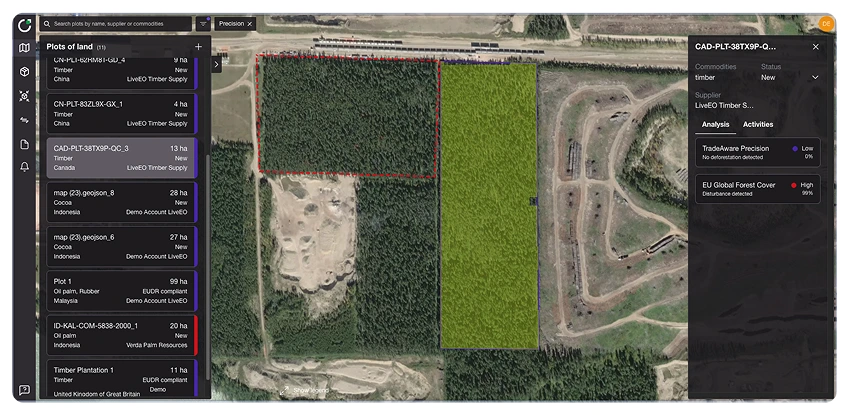
Precision Analytics goes beyond tree cover loss to detect true deforestation and degradation. You won’t miss critical land-use changes that could lead to non-compliance or regulatory penalties.
Faster Compliance, Lower Cost
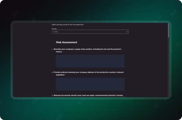
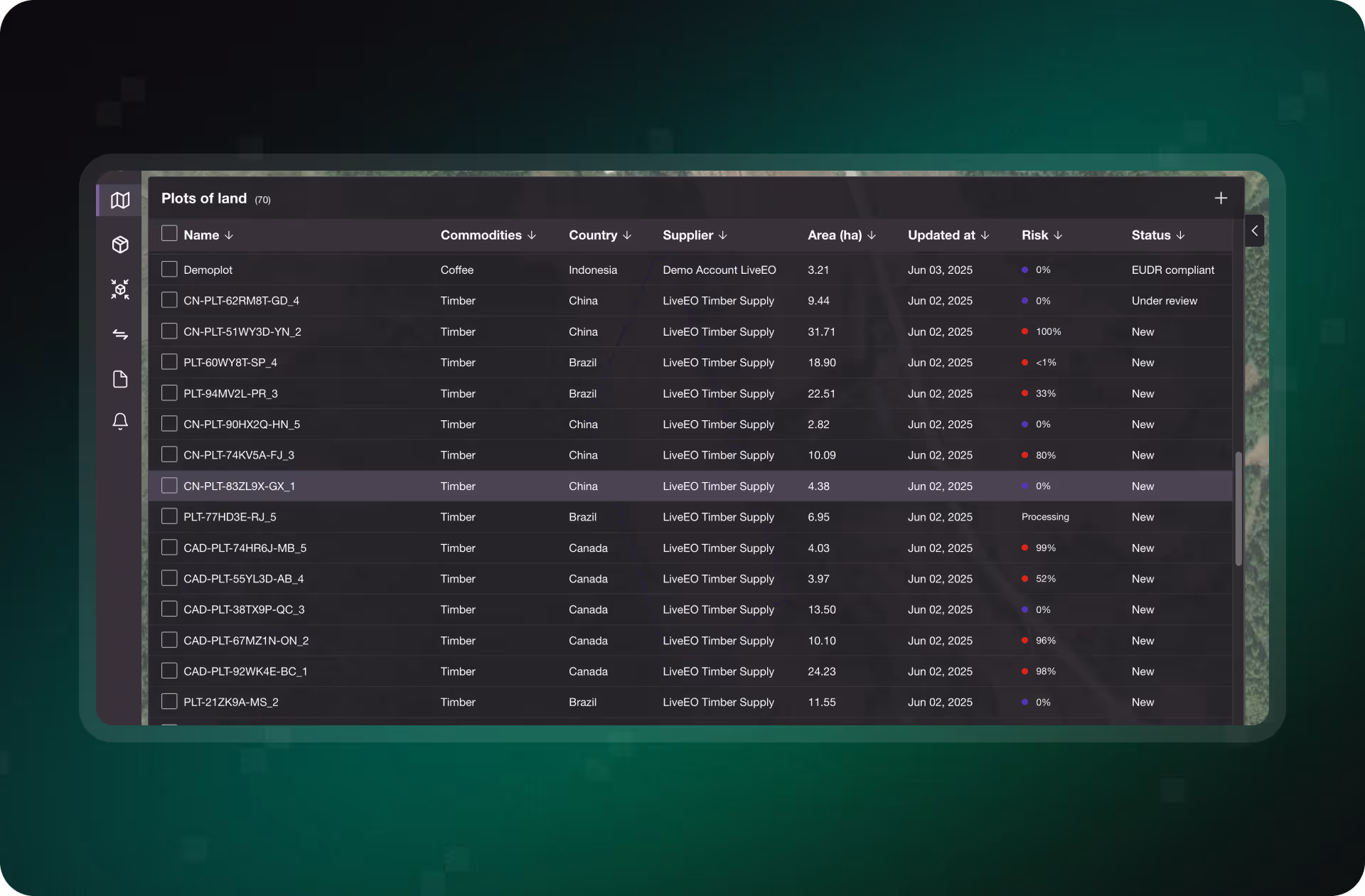
With plot-level assessments that require minimal verification, you can reduce internal workload, lower compliance costs, and accelerate your due diligence timelines, even across thousands of suppliers.
Large-Scale Processing With Local Precision
Analyze land-use change across vast supplier networks with spatio-temporal AI models built for scale. Precision Analytics ensures consistent, reliable results, no matter how fast your operations grow.

“We work with a large and diverse supplier base across multiple markets, both within and outside Europe, and the support we receive from the LiveEO team has been excellent. Their expertise and flexible technology solutions play a crucial role in helping us drive EUDR compliance across a complex and varied value chain.”

.webp)
Make EUDR Compliance Decisions Backed by Evidence
TradeAware’s Precision Analytics transforms raw satellite data into compliance-grade insight. By combining high-resolution imagery, machine learning, and EUDR-aligned definitions, the system delivers accurate, audit-ready results that integrate seamlessly into your due diligence workflows. Whether you’re reviewing a single supplier or thousands of plots, analysis is automated, scalable, and ready for submission.
.avif)
Machine Learning That Understands What Deforestation Really Means
TradeAware’s Precision Analytics engine applies EUDR-aligned definitions of deforestation and forest degradation to detect true land-use change, not just tree cover loss. Using multi-temporal, 5m-resolution satellite imagery, our machine learning model identifies changes with over 98% accuracy, reducing false positives and negatives and helping protect compliant plots from wrongful exclusion.
- Trained on EUDR definitions of deforestation and degradation
- Multi-date, high-resolution (5m) satellite image analysis
- >98% classification accuracy, continuously improved via QA
- Supports legally defensible DDS documentation

Automate Plot Analysis Directly From Your ERP
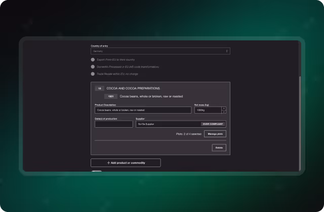
TradeAware connects to your ERP or procurement systems via bi-directional API, allowing you to trigger precision deforestation checks automatically, at any scale. Submit plots in bulk via GeoJSON, including buffer zones, and receive DDS-ready results without slowing down operations or overloading your team.
- Trigger analysis directly from your ERP via API
- Batch upload of plots, including buffers for point-based data
- Receive audit-ready outputs in real time
- Lower operational overhead and reduce time-to-compliance
Detect Deforestation With Confidence and at Scale
See how TradeAware’s Precision Analytics helps you identify true land-use change using EUDR-aligned AI models and high-resolution satellite imagery, reducing false positives, preserving supplier relationships, and accelerating due diligence at scale.
What Precision Looks Like in Practice
TradeAware customers rely on Precision Analytics to validate land use, reduce false positives, and accelerate supplier approvals. Explore how teams are replacing low-resolution guesswork with scalable, evidence-based compliance, and protecting revenue while doing it.

“Partnering with LiveEO allows us to establish a platform for gathering information from our suppliers, validating it, storing it, and ultimately sharing it with our customers in a form that is easily submitted to the EU TRACES system. Reaching that decision was a milestone moment in the project.”


FAQs
Understand how TradeAware’s Precision Analytics ensures accurate, defensible deforestation assessments aligned with EUDR requirements.


How does Precision Analytics determine if deforestation occurred after the EUDR cut-off date?
Precision Analytics uses multi-temporal satellite imagery to detect land use changes over time. The model compares imagery before and after the EUDR cut-off date (December 31, 2020) to determine whether deforestation or degradation occurred in violation of the regulation.
What definitions of deforestation and forest degradation does the model use?
The model is aligned with EUDR definitions, distinguishing between deforestation (conversion of forest to non-forest) and forest degradation (conversion of primary or naturally regenerating forest into plantation forest or other wooded land). These definitions are applied consistently across all analyses for regulatory accuracy.
What satellite imagery sources are used in Precision Analytics?
We use a proprietary combination of high-resolution satellite data sources, including Sentinel-2, to achieve an effective resolution of 5 meters. This spatio-temporal approach ensures both spatial and time-based accuracy in land change detection.
How is Precision Analytics different from open-source datasets like JRC-GFC?
Unlike open-source datasets, which often detect only gross tree cover loss, Precision Analytics evaluates land use change through AI models that apply EUDR-specific definitions. This enables more accurate, regulation-aligned decisions and significantly reduces false positives and negatives.
What is the error rate or confidence level of the deforestation classification?
Our model achieves up to over 98% accuracy, validated through customer ground-truthing and internal quality assurance. Continuous improvements via manual reviews help ensure the model stays aligned with both real-world conditions and evolving regulatory expectations.
Will the result of your analysis be recognized by the CNA?
While recognition ultimately depends on the national authority (CNA), TradeAware provides auditable, EUDR-aligned analysis and traceable documentation. This makes it much easier to defend your due diligence process during inspections or audits.
How can I trigger a Precision Analysis on my plots?
You can trigger analysis manually via the TradeAware interface or programmatically via API. Batch submissions (including GeoJSON files with optional buffer zones) are supported to help you process plots at scale with minimal manual input.
Can I override or challenge a deforestation classification if I believe it’s incorrect?
Yes. Users can flag results for manual review, add comments, and upload supporting documentation. Our support team will reassess the classification and, if needed, perform a manual override with a documented rationale.
What kind of output does the Precision Analytics model generate?
Each analysis produces a standardized, DDS-ready output showing the deforestation status, map overlays, timestamps, and analysis rationale. All results are exportable and stored with a full audit trail for regulatory and internal review purposes.
How long does it take to become compliant with TradeAware?
You can start your compliance process in TradeAware on day one, with no waiting period or complex setup. TradeAware’s intuitive, award-winning interface (recognized with the Red Dot Design Award) makes it easy for teams to onboard quickly, and our standard ERP connector makes the system integration fast. In practice, the pace of compliance depends largely on how fast suppliers provide the required data. TradeAware shortens this critical step through guided supplier onboarding and automated data collection. With engaged suppliers and data readiness, it is possible to achieve full compliance in a matter of weeks.