
Confidently Verify and Communicate Your DCF Progress
Gain deep visibility into your supply chain and remotely verify conversion-free commodities with high accuracy.
TradeAware gives you verifiable, high-accuracy insight into whether your sourcing is truly deforestation- and conversion-free (DCF). By combining satellite monitoring, multi-tier supply chain visibility, and legal verification in one platform, you get a complete, defensible view from farm to market. Measure verified DCF volumes, automate reporting, and move from commitments to evidence-based control. Strengthen access to capital, increase consumer trust, and make your supply chain more resilient.
A Weak Deforestation-Free Program Hurts Your Bottom Line
Investors and consumers increasingly rely on Deforestation- and Conversion-Free (DCF) rankings, and they avoid companies that score poorly. Strong commitments aren’t enough. To protect access to capital, prevent supply chain disruptions, and maintain consumer trust, companies need effective implementation and transparent, defensible reporting.
Reputation with Consumers and Banks on the Line
Banks increasingly use benchmarks like Forest500 to inform lending decisions, rewarding high scorers with better terms and penalizing low performers. At the same time, institutional investors and ETFs divest from weak ESG performers, putting pressure on share prices. Environmentally conscious consumers are also shifting toward higher-scoring brands, making DCF performance a direct driver of market preference.
Ineffective and Resource-Intensive Processes
Complex supply chains cannot be managed through spreadsheets, and data from lower-tier suppliers is difficult to obtain, verify, and trace. Effective oversight requires automated workflows and a fully digital, end-to-end mapping of the supply chain, something manual processes simply cannot deliver at scale.
Many companies aim for zero deforestation but hesitate to commit when existing methods risk excluding compliant suppliers. Inaccurate or outdated assessment tools produce false positives, leading to unnecessary supplier drops, shipment delays, or increased operational costs, all of which undermine supply chain continuity.
Confidently Verify and Communicate Your DCF Progress
Gain deep visibility into your supply chain and remotely verify conversion-free commodities with high accuracy.
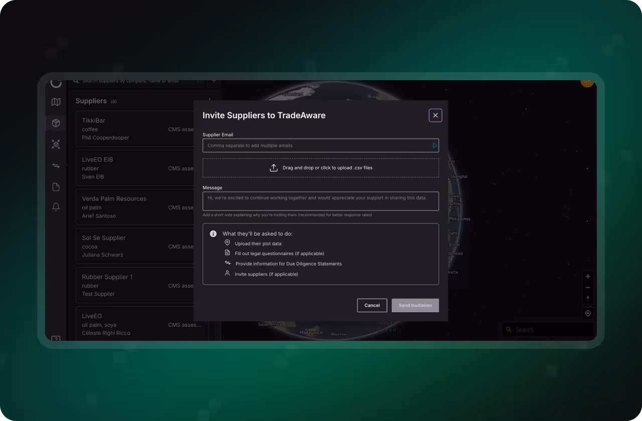

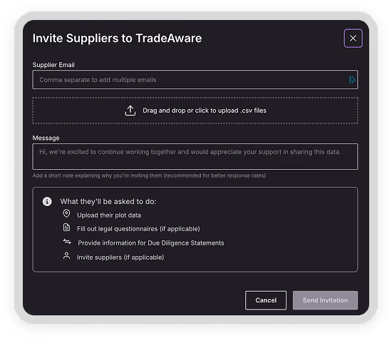
Collect Data Across Supply Chain Tiers
TradeAware’s commercial network uses a low-threshold invite flow that enables secure data sharing across multiple supply chain tiers. Thousands of suppliers are already active on the platform, making onboarding fast and straightforward. With lawyer-vetted supplier questionnaires and ERP-integrated workflows, all required data is collected, verified, and organized in one place.
.avif)
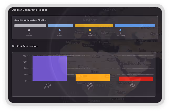
Verify Thousands of Plots, Fast and Accurately
TradeAware is built for due diligence at scale. The platform processes thousands of sourcing plots across multiple commodities in parallel, delivering high-accuracy results you can rely on. This reduces errors, prevents unnecessary supplier exclusions, and protects the continuity of your supply chain.

Results That Are Ready to Act On, and Ready to Report
Get supplier status updates directly in your ERP and use clear, informative dashboards to guide data-driven workflows. TradeAware includes a documented methodology for reporting and exportable summaries with key KPIs, making external disclosures and internal decision-making simple, consistent, and defensible.
Different frameworks use different cut-off dates and definitions for what counts as a relevant land-use conversion. Public open-source datasets often apply generic rules that overclassify land as deforested, creating unnecessary risk and supply chain disruption. TradeAware’s Precision Analytics evaluates each plot against the exact framework you are optimizing for. delivering high-accuracy assessments with dramatically reduced error rates.

Join leading ESG and procurement teams already streamlining conversion-free sourcing with TradeAware. Reduce uncertainty, save time, and confidently report your progress to the public.
Find clear answers to the most common questions about how TradeAware verifies deforestation-free sourcing, strengthens reporting, and simplifies end-to-end DCF risk management.
Suppliers are invited directly through TradeAware via structured email invitations. Each invite links to a guided onboarding flow where they can securely submit geolocation data, legal documents, and other EUDR-required information.
Yes. TradeAware supports cascading onboarding, enabling your direct suppliers to onboard their upstream partners, which is key to achieving full multi-tier traceability.
Yes. Supplier access to TradeAware is completely free, helping maximize participation and reduce barriers to compliance collaboration across the supply chain.
We use a proprietary combination of high-resolution satellite data sources, including Sentinel-2, to achieve an effective resolution of 5 meters. This spatio-temporal approach ensures both spatial and time-based accuracy in land change detection.
Unlike open-source datasets, which often detect only gross tree cover loss, Precision Analytics evaluates land use change through AI models that apply EUDR-specific definitions. This enables more accurate, regulation-aligned decisions and significantly reduces false positives and negatives.