Proactive Wildfire Defense

See The Risk Before The Spark

Patrols and fixed inspection cycles can’t keep pace with hazard trees, volatile fuel loads, and fast-changing fire conditions. Treeline enables a proactive defense. By combining satellite imagery, AI-driven hazard scoring, and fuel monitoring, Treeline highlights the spans most likely to ignite, guides targeted mitigation in High Fire Risk Areas, and delivers audit-ready proof of risk reduction.

Contact us

Trusted by Leaders Worldwide

Our customer stories
The Problem

Wildfire Risk Is Rising Faster Than

Utilities Can Keep Up

Hazard trees, stressed vegetation, and volatile fuels are multiplying under hotter, drier conditions. Meanwhile, aging infrastructure increases the chance that contact sparks ignition. Traditional vegetation management, based on patrols and fixed cycles, is too costly, too slow, and leaves blind spots. Without defensible proof of prevention, utilities face skyrocketing liability, stricter regulation, and reputational damage when fires ignite.

Ignition Sources Multiply

Hazard trees weakened by disease, decay, or drought can fall into lines without warning. Combined with dense, dry vegetation, they create dangerous conditions for fast-spreading wildfires.

Patrols Miss Fast-Changing Risks

Ground and aerial inspections are expensive and infrequent. With wildfire seasons growing longer and more intense, utilities need precise prioritization that can keep pace with rapidly shifting conditions, guided by recent data insights.

Compliance Demands Proof

Regulators require auditable evidence of wildfire mitigation. Without standardized, verifiable records, utilities struggle to defend themselves in audits, claims, or court, putting billions in financial and reputational risk on the line.

Every Missed Risk Carries High Stakes

Wildfire liabilities can bankrupt utilities, shutoffs erode customer trust, and preventable ignitions damage investor confidence. Each missed hazard is more than a safety risk, it compounds across the grid, turning small oversights into system-wide vulnerability.

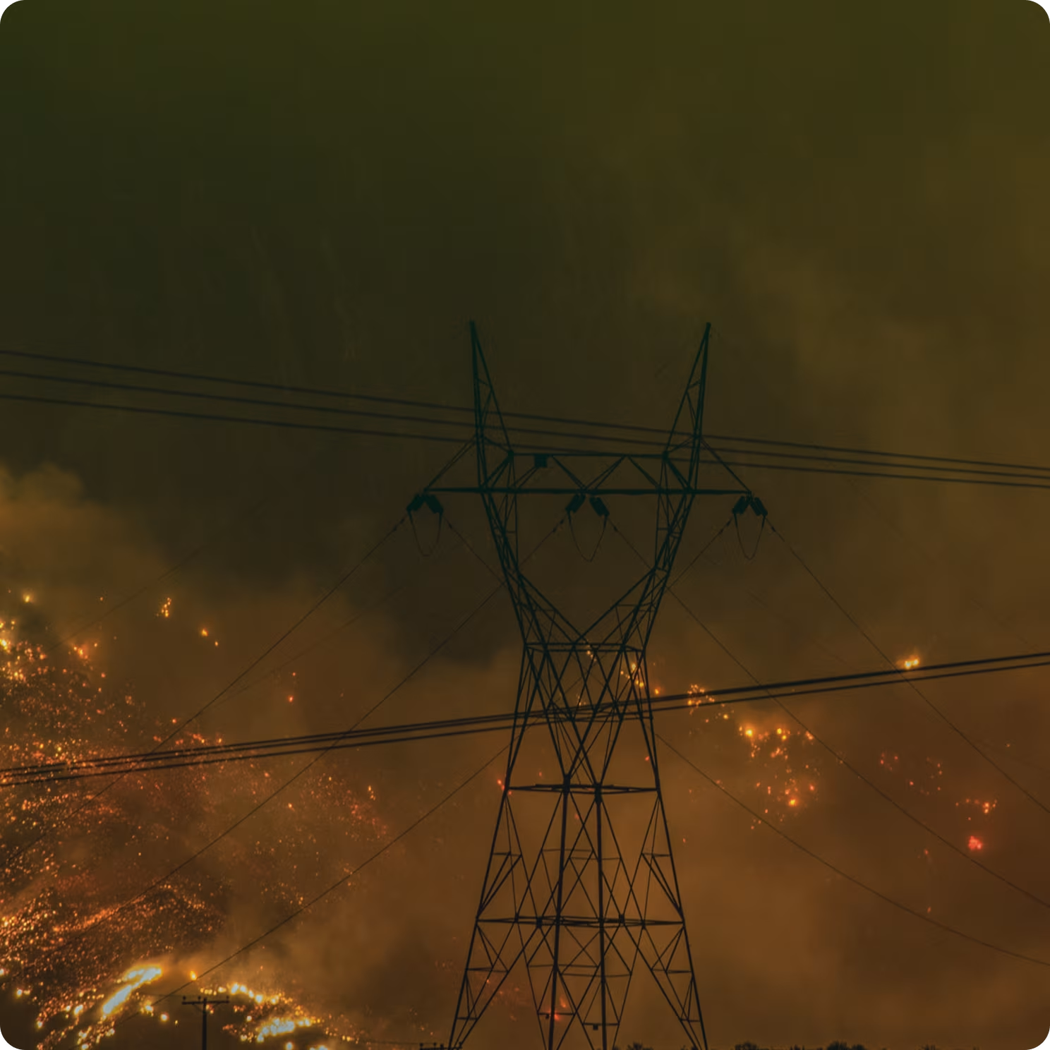
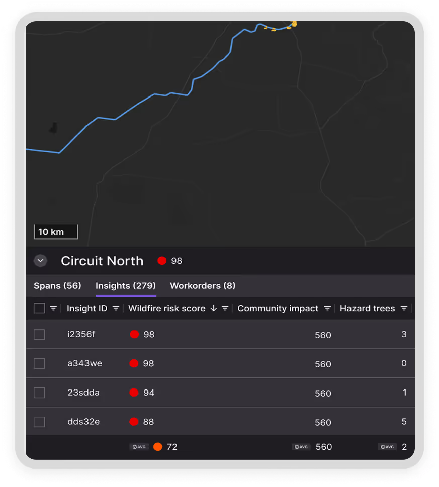
How Utilities Defend Against Wildfire Risk With Treeline

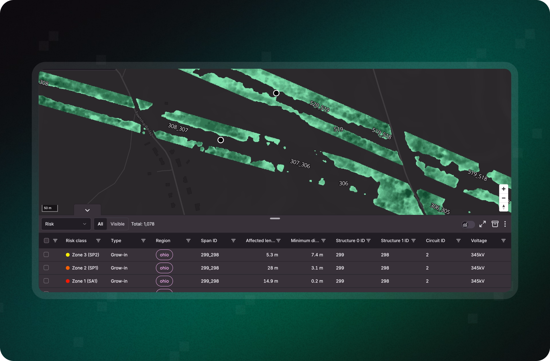
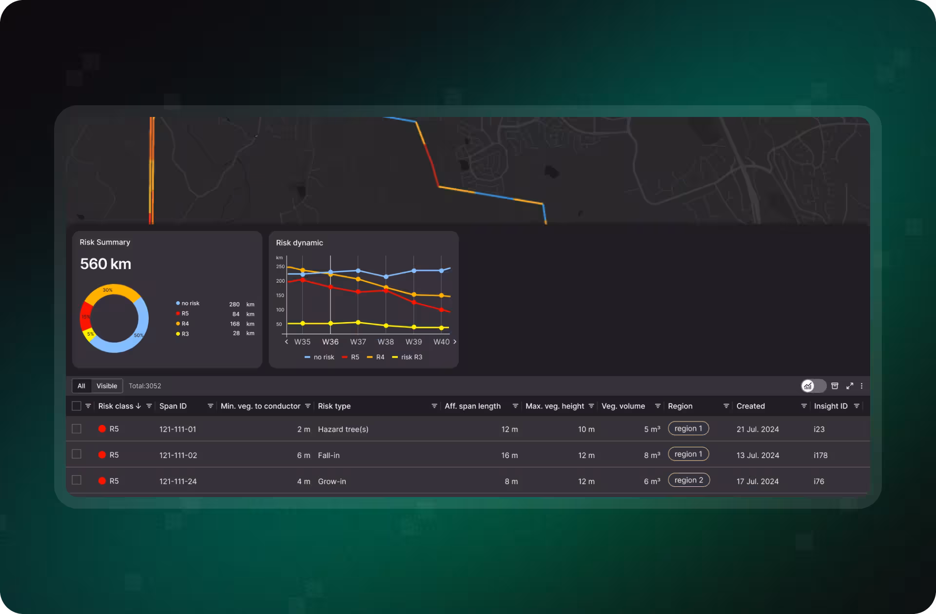
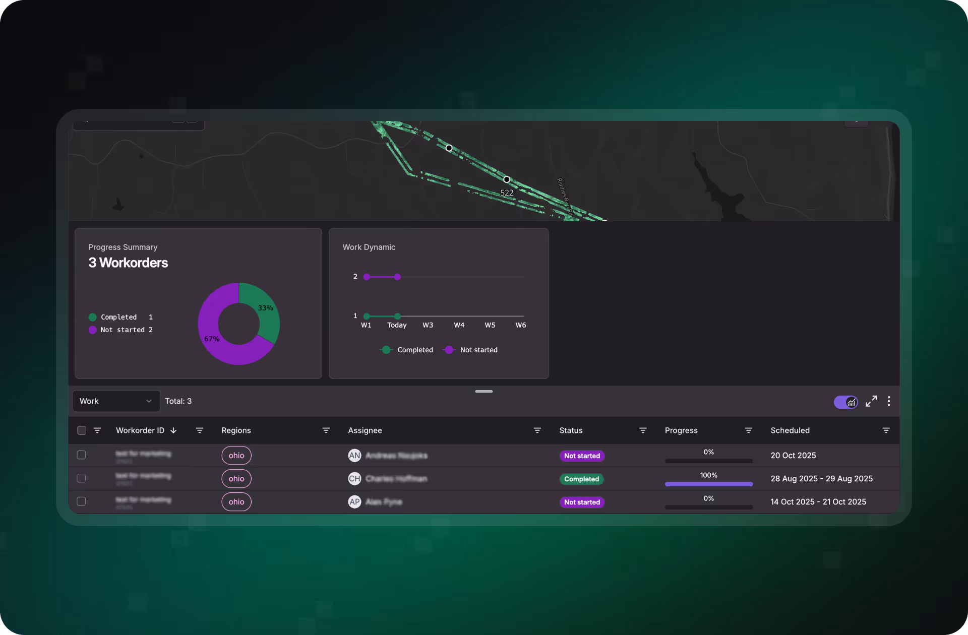
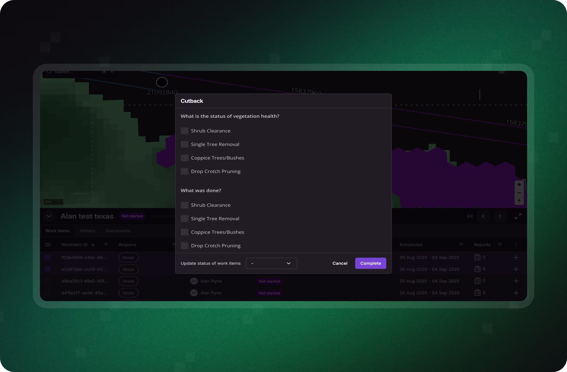
Treeline equips utilities with continuous, span-level insights into wildfire hazards. By combining satellite imagery, AI-driven risk modeling, and fuel monitoring, Treeline helps detect ignition threats early, focus resources on the spans most at risk, and generate defensible proof of prevention efforts for regulators, insurers, and communities.

Automated Risk Detection and Classification

Spot Ignition Threats Before They Escalate

Treeline continuously scans clearance zones and surrounding corridors to detect flammable vegetation, fall-in risks, hazard trees, and stressed canopies. By combining encroachment detection, vitality insights, and fuel load mapping, utilities gain near-LiDAR precision visibility into the conditions most likely to spark wildfires.

Learn more
Risk Prioritization Engine

Focus on the Spans Most Likely to Ignite

Treeline’s wildfire risk model scores every span by ignition potential, combining vegetation type, tree vitality, proximity to conductors, and overlays with High Fire Risk Areas and more. This enables utilities to rank spans by fire risk severity and direct resources where intervention prevents the greatest risk.

Learn more
Work Management

Turn Wildfire Risk Into Targeted Mitigation

Insights are converted into map-based work orders with full hazard context, from fall-in and overstrike trees to dense fuel zones. Crews receive clear instructions to target the highest-risk spans in HFRAs, supervisors track progress in real time, and every intervention is verified with GPS- and photo-based proof.

Learn more
Reporting Tools

Prove Wildfire Prevention With Defensible Records

Treeline streamlines wildfire compliance with dashboards, audit-ready cutback verification, and standardized evidence packaging. From before-and-after photos to span-level fuel reduction logs, utilities can demonstrate proactive risk reduction to regulators, insurers, and communities, strengthening defensibility and public trust.

Learn more

Stay Ahead of Hazard Trees and Fuel Loads Before They Ignite

Don’t wait for inspections to reveal the next ignition source. Treeline gives you continuous, span-level wildfire risk insights, from hazard trees to fuel loads, so you can act early, reduce liability, and demonstrate defensible prevention to regulators, insurers, and communities.

Contact us
Case Studies

Smarter Vegetation Management in Action

See how utilities are using Treeline’s satellite- and AI-powered vegetation insights to cut inspection costs, reduce wildfire risk, and improve grid reliability.

"The LiveEO technology gives us a better overview of the vegetation along our tracks. It allows us to address the consequences of climate change even better."

Head of Infrastructure
Safe railways, healthy forests with Deutsche Bahn. Discover why it matters today.
Read more

“Westerville Electric went with LiveEO and our outage rate in 2022 was 18%. We are now at 10%. This is the future of vegetation management!”

Joseph DeLong
Utility Forester
Keeping the Lights on in Westerville: 41% Fewer Outages with Vegetation Management Satellite Tech. Discover why it matters today.
Read more

"The possibility to check our network with satellite images and AI as well as the strong customer focus of LiveEO have excited us from the beginning. Innovative partners like LiveEO and new technologies are an important pillar for us as a grid operator to make our network even more efficient and reliable."

Sven Mögling
Project Manager
E.DIS Case Study - Enhancing Vegetation Management with Satellite Analysis. See how it’s shaping the future.
Read more

FAQs

Get answers on how Treeline helps utilities detect wildfire risks earlier, focus mitigation where it matters, and prove prevention to regulators and insurers.

Still have questions?
Contact us

How does Treeline verify that cutbacks were done correctly?

Treeline compares before-and-after vegetation conditions against AI-driven clearance recommendations, confirming whether spans meet required standards.

Can Treeline hold contractors accountable for their work?

Yes. Treeline provides objective, span-level proof of completed work, reducing disputes and ensuring contractors deliver to specification.

How does Treeline help with compliance and audits?

Every verified cutback is logged with standardized evidence, including geotagged records, creating defensible documentation for regulators and insurers.

Will Treeline integrate with our existing systems?

Absolutely. Treeline connects with platforms like ESRI, SAP, Trimble, and Clearion, making it easy to tie verification results directly into your vegetation management workflows.