
We have all seen those movies - the hero (on the run) tries their best to go undetected.
Hat and sunglasses are their instruments of choice to escape suspicious glances from people nearby. Taking shelter from the open sky is another to prevent being seen from afar - knowing well that enemy spy satellites can track their every movement from above.
Fortunately, scenarios like this still belong in the realm of science fiction.
While few people know how capable military-grade reconnaissance satellites are today, we know for certain that commercial satellites - the ones we use at LiveEO to procure imagery - are not designed for that kind of surveillance operations.
Not an action movie, but still exciting
However, one would be mistaken to underestimate the accuracy and depth of detail of imagery provided by modern commercial EO satellites in the earth’s orbit in growing numbers.
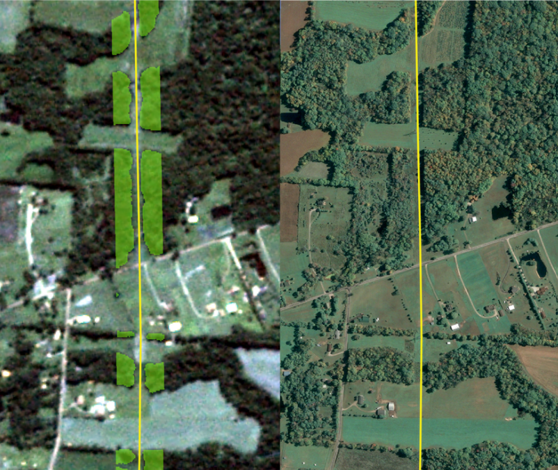
For our vegetation management solution, we use satellite imagery from a variety of satellites and providers with varying resolutions. Depending on the use case, the images have a spatial resolution between 10ft/3m per pixel on the crude end and get as fine as 1ft/30cm on the highest quality end.
But how fine is a resolution of 30cm/pixel?
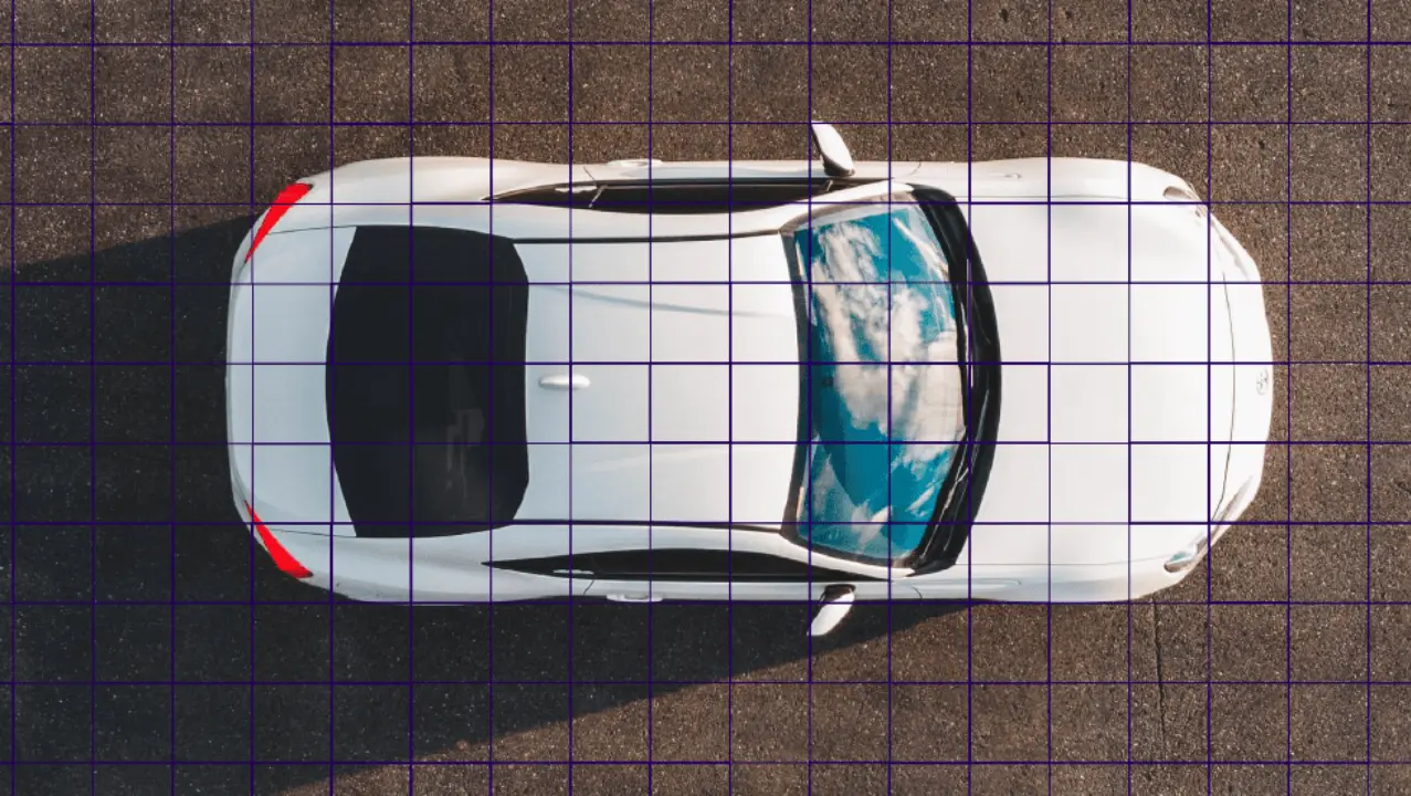
Let’s illustrate this using a picture of a car (image below). The raster put on top of the car symbolizes typical resolutions of different satellites.
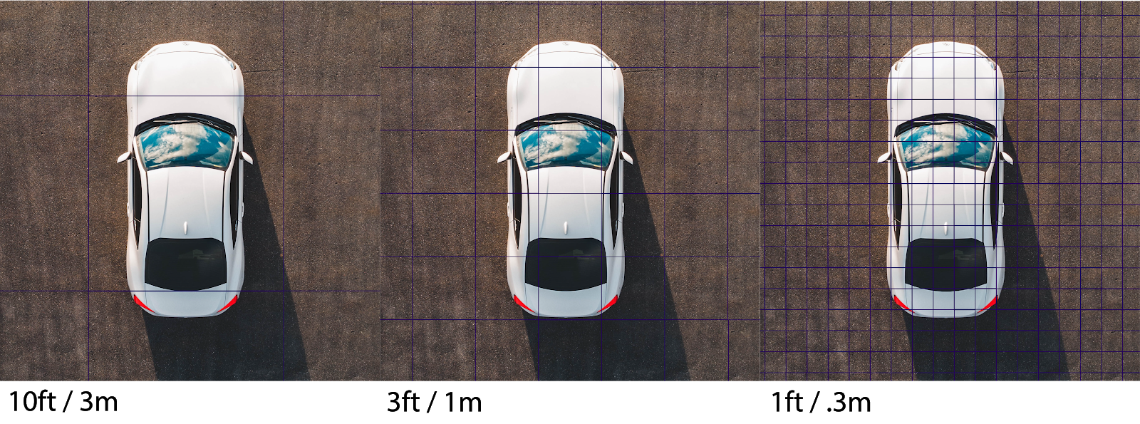
We can see that for the 10ft/3m resolution, the car pretty much fills up one pixel.
In a satellite image, we would be able to make out a light dot with blurry edges above and below resulting from the half-filled pixels.
On the 3ft/1m data, more details can be distinguished. We would be able to tell apart the windshield and back window as dark areas on an otherwise white object.
For the image with the highest resolution of 1ft/.3m,even smaller details like side windows, the shape of the car’s body and even the side mirrors and rear lights can be identified.
We would, without doubt, identify the object as a car.
{{inline}}
What resolution is required for effective vegetation management?
Depending on the use case for vegetation management software, different resolutions can be selected.
In order to generate an overview where vegetation along the network exists, a resolution of 10ft/3m is generally sufficient.
In order to effectively detect encroachment from the sides into the ROW, higher resolutions can become necessary, especially so where the clearance for vegetation is narrow and regulations are strict.
Why not always go for the highest resolution?
Using the highest resolution for every analysis would undoubtedly yield most precise outcomes, so why not do so?
The reason lies in the cost associated with different satellite images.
As a rule of thumb there are two main factors determining the cost of satellite imagery: up-to-dateness and resolution.
For an up-to-date analysis, only one of these factors remains variable. In order to keep the cost low for our customers, we advocate to always use the appropriate resolution for the use case at hand.
If our customer’s goal is to know where vegetation is, in order to better plan operations and organize their workforce, 10ft/3m data might be the best solution.
If the requirement is to identify single trees or to validate smaller cutbacks, resolutions below 3ft/1m could be the way to go.
Get in touch!